A severe weather warning is in place for the Bay of Plenty as a front and associated low moves east over the North Island today.
While the warning is predominately for the Eastern Bay, residents in the Western Bay are being warned to expect periods of heavy rain throughout the day.
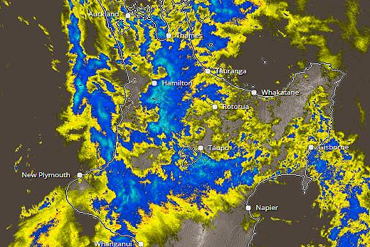
A severe weather warning and watch is in place for the Bay of Plenty today. Image: MetService.
The MetService says the low is forecast to become slow-moving and deepen east of Gisborne as the day moves on.
'About the ranges of northern Hawkes Bay and Gisborne, 100 to 150mm of rain is likely between midday on Wednesday and midday on Thursday, with the possibility that 200mm could fall in some places,” says a statement from the weather organisation.
'In addition, the southerly flow is expected to strengthen over the North Island as this low deepens, with severe gale southerlies gusting 130 km/h expected about exposed parts of Gisborne and the Eastern Bay of Plenty.”
People are advised that this amount of rain may cause rivers and streams to rise rapidly, with slips and surface flooding possible.
In addition, severe gale southerlies may bring down trees and powerlines in exposed areas, and make driving hazardous for high-sided vehicles and motorcycles.
The MetService is also warning that rain is expected to turn to snow above 900 metres late on Wednesday afternoon on the Desert Road.
'During Wednesday evening and early Thursday morning, one-to-three centimetres of snow could accumulate near the summit.”
Tomorrow's forecast in the Bay is for early showers, becoming fine with southerly winds.
According to the MetService's five day forecast, the weather on Friday is expected to be fine with southerlies easing.

0 comments
Leave a Comment
You must be logged in to make a comment.