Forecasters are warning of potential for severe thunderstorms across the central North Island later today – bringing a risk of slips and flash flooding.
MetService has issued a severe thunderstorm “watch” from 3pm to 10pm this afternoon and evening, covering a large area from southern Waikato and eastern Waitomo to Taumarunui, Taupō and to the far southwest of Rotorua.
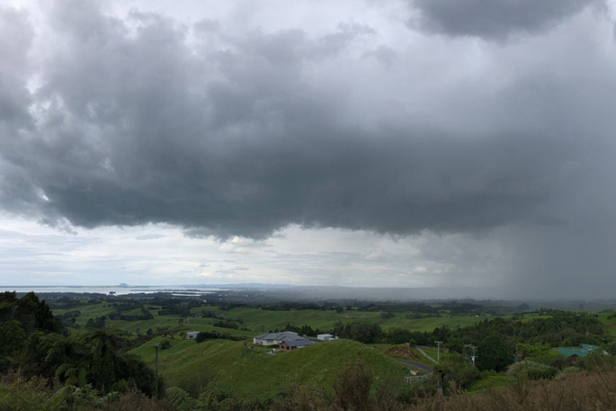
Some of those thunderstorms could also be slow-moving, severe and capable of localised downpours of 25mm/h to 40mm/h.
That meant the potential for surface and flash flooding – especially about low-lying areas like streams, rivers and narrow valleys – while making for hazardous driving conditions.
MetService meteorologist Clare O’Connor said thunderstorm risk came from a combination of light wind and summertime heating making for unstable air.
“They’re both going to allow those thunderstorms to form – but the risk is potentially localised heavy rain, as the light winds mean the thunderstorms won’t move too far from where they form.”
O’Connor said these storms could develop quickly – and forecasters were ready to issue local red warnings if they saw one form.
“We do have red warnings that come through as push notifications on our app – or otherwise, people can keep up to date by visiting our severe weather web page.”
Today’s weather action comes just days after heavy thunderstorms over the Central North Island saw a Taupō man thrown off his feet by a lightning strike.
Meanwhile, MetService is also closely watching a low pressure system in the Coral Sea, east of Australia, that may deepen today – but there’s still a low chance of it forming into a tropical cyclone.
The agency’s latest bulletin gave a “low” risk – or a 5% to 20% probability – of the system developing into a cyclone on Monday and Tuesday and a less than 5% risk thereafter.
O’Connor said that, if a cyclone did form, New Zealand would likely be buffered from dominant high pressure over the country.

0 comments
Leave a Comment
You must be logged in to make a comment.