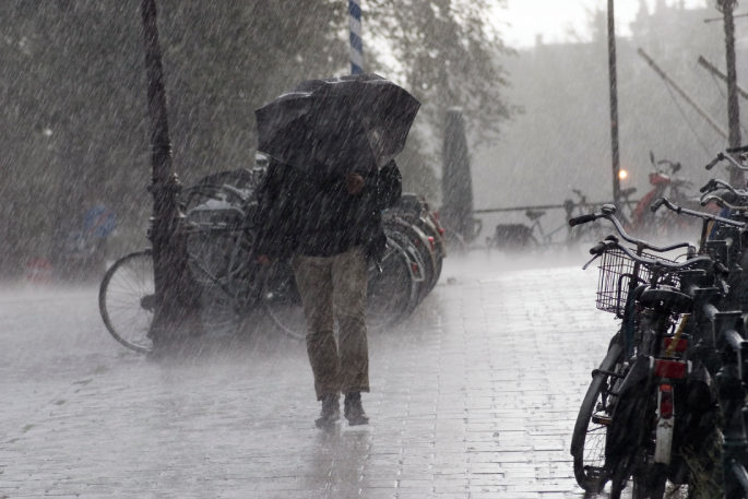
Severe gales up to 140km/h and torrential downpours set to begin overnight have prompted MetService to upgrade weather warnings for Auckland and the upper North Island.
The Auckland Harbour Bridge could be closed or have speeds reduced at short notice, a spokesman for NZ Transport Agency said.
A deep subtropical low is bearing down on the top of the country, with the days-long deluge and severe winds hitting overnight.
MetService has issued an orange heavy rain warning and a strong wind warning for Northland, Auckland and Great Barrier Island, coming into force at 3am tomorrow.
Up to 180mm of rain is expected to fall in 41 hours until midnight Thursday. Thunderstorms are expected to barrel in on Thursday.
MetService said the orange heavy rain warning could be upgraded to a red warning.
Low pressure will emerge from the tropics & move into the northern Tasman Sea.
— NIWA Weather (@NiwaWeather) April 14, 2025
The track & behaviour of the low will be critical for determining where the worst weather occurs.
Folks at @MetService have watches & warnings up. Best to stay up-to-date over the coming days. pic.twitter.com/0z62zlVMwU
“Streams and rivers may rise rapidly. Surface flooding, slips and difficult driving conditions are possible,” MetService said.
Severe gales up to 140km/h are expected in exposed places. Tree damage, downed powerlines and lifting of unsecured structures are likely, MetService said.
Heavy rain and strong wind watches have also been issued for the Coromandel Peninsula, Waikato, Waitomo, Taumarunui, Taihape, Taranaki and Buller. These begin at midnight tonight and should lapse by 6am Friday.
In the Bay of Plenty west of Kawerau, the rain is expected to start falling about noon on Thursday and won’t stop until the following lunchtime.
MetService is warning of a high chance the alert will be upgraded to a warning, with streams and rivers expected to rise rapidly.
A strong wind watch is also in place from midnight Wednesday across the Coromandel Peninsula, Waikato and Waitomo with more than a day of wild, potentially damaging winds expected to blast the regions.
“Clear your drains and gutters to prepare for heavy rain. Avoid low-lying areas and drive cautiously,” MetService said.
“Prepare your property by securing items that can be picked up by strong winds.”
Wet and windy ahead of Easter break
— MetService (@MetService) April 13, 2025
Strong Wind and Heavy Rain Watches are in place from Wed for Northland, Auckland and Coromandel - with a good chance of being upgraded
A good week to keep a close eye on the forecast, especially if you’ve got travel plans pic.twitter.com/l7iSbCOVuL
MetService forecaster Alec Holden told the Herald a large, low-pressure system was heading towards New Zealand from the north.
“There [is] a high chance these watches will be upgraded to warnings,” he said.
Holden said 90km/h gusts around Auckland and Northland would be a safe estimate.
“The gust number of 90km/h could be higher,” he said.
“The northeasterly winds haven’t been particularly common in well over a year.
“There is a definite risk [of] damage of trees.”
In an online update, Northland Civil Defence advised residents to check drains and gutters in the lead-up to the storm and make sure outdoor furniture and loose items were secured.
“Make sure you have supplies ready in your home and car in case of power outages or road closures,” it said.

0 comments
Leave a Comment
You must be logged in to make a comment.