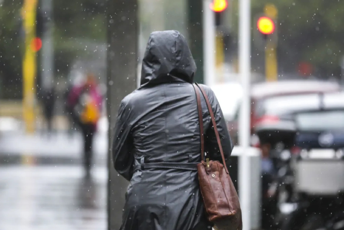
Strong winds and heavy rain are lashing the North Island as a tropical cyclone moves close to New Zealand.
Tropical Cyclone Tam is expected to bring sustained heavy rain and severe easterly gales to many areas of the North Island and upper South Island today through to the weekend.
It is likely to be reclassified as an ex-tropical cyclone as it moves away from the Pacific and past the top of the North Island overnight, however, forecasters are still warning it could pack a punch.
Where and when will the weather arrive?
The wet and windy weather is expected to effect the upper and western North Island first before moving slightly east down the country and to the top of the South Island.
Northern parts of the North Island are already seeing the onset of forecasted heavy rain and strong winds are expected to ramp up.
Northland is forecasted to bear most of the brunt, with the bulk of the rain expected later on Wednesday morning.
MetService said rain in the region would ease on Wednesday afternoon and evening. However, Thursday would likely see peak rates of 15 to 25 mm/h and possible thunderstorms.
From Wednesday afternoon through to Thursday night, Northland is forecasted to receive severe gale easterlies gusting 120 km/h in exposed places, with damaging gusts of 140 km/h possible overnight Wednesday and Thursday morning.

"It's been a very long time since we've seen wind speeds of that magnitude from that wind direction so definitely something quite notable," MetService meteorologist Mmathapelo Makgabutlane told Morning Report.
Severe gale easterlies gusting 120 km/h is forecast for Auckland on Wednesday night, with heavy rain arriving early Thursday morning.
The weather system is expected to extend further east towards Coromandel, Bay of Plenty and top of Tai Rāwhiti Gisborne on Thursday morning, Makgabutlane said.
As we head towards the end of the week, Makgabutlane said the shift focuses to the top of the South Island.
While most of the country are expected to see some wet weather this weekend, Makgabutlane said there will be some dry spells in places such as Southland.
Warnings and watches in place
MetService had issued 10 weather warning and watches across the country by Wednesday morning, with the chance of some being upgraded to the most severe category.
MetService issues Severe Weather Warnings whenever there is an expectation that any of the following weather conditions will occur within the next 24 hours. There could more issued as the system moves over the country later this week.
Northland is currently under an orange heavy rain warning, with a low chance the warning will upgrade to red. An orange wind warning will come into force for the region later on Wednesday afternoon with a moderate chance of being upgraded to a red warning.
Auckland and Great Barrier Island are under heavy rain watches, with a moderate chance of being upgraded to a warning. On Wednesday night, an orange wind warning will be in place, with a low chance of being upgraded to a red warning.
Coromandel Peninsula and parts of Bay of Plenty have been issued a heavy rain watch for Thursday, with high chances of being upgraded to a warning.
Coromandel Peninsula, Waikato and Waitomo have been issued a strong wind watch from midnight Wednesday, with high chances of being upgraded to a warning.
Taumarunui, Taihape and parts of Taranaki have been issued strong wind watches from Thursday morning, with a moderate chance of those being upgraded to warnings.
Meanwhile, Buller is the only place in the South Island to have a warning issued for the next 24 hours. It is under a strong wind watch, with a moderate chance of being upgraded to a warning.

Official advice
Civil Defence Northland said local emergency services, councils, contractors, and partner agencies, including health and welfare agencies, have all been working on their preparations and are ready to respond if necessary.
With many people likely to be heading away for the Easter holidays, drivers are urged to drive to the conditions and plan for disruptions.
"We are starting to see some heavy rain make its way across parts of the region. So, as you head out this morning, please drive to the conditions, take extra care, and report any weather-related issues on the roads or in public areas to the local council," Civil Defence Northland said.
MetService said there is a risk of surface flooding and slips across the country.
The weather forecasting agency has advised Northland and Auckland residents to clear their drains and gutters, and secure items that could be picked up by strong winds.
Auckland Transport said there would be a higher safety risk out on the roads, and some public transport services may also be affected, especially ferries.
"Make sure you check the forecast when planning any weekend travel or activities and check it again for any changes before you go out. Don't forget, if you're heading to another region, check the weather there too," Auckland Emergency Management general manager Adam Maggs said.
"A bit of rain has softened ground conditions over the last week so we could start to see some surface flooding if heavy rain eventuates."
Parts of Northland have already experienced power outages, however, the cause is not yet known.
Power suppliers have told customers to charge their devices as the weather may cause outages, mostly caused by trees and branches coming down over power lines.
RNZ is the statutory civil defence lifeline radio broadcaster and will be providing vital information and updates as they come to hand. Check out the frequencies here.

0 comments
Leave a Comment
You must be logged in to make a comment.