
Rain is expected to sweep across the region as people prepare to wrap up the week.
MetService said there is a stock standard bout of rain passing over the country today, with just about everyone seeing some spots.
“While you won’t be able to dry that washing outside, it’s nothing to write home about.”
The more interesting weather comes on Friday and Saturday.
On Friday, periods of rain and showers move from the northwest over the North Island and top of the South Island, brought on by active rain bands associated with a low-pressure system.
Squally thunderstorms and hail with localised heavy falls are possible for Auckland and Northland in the evening and at night.
Heavy rain is also expected to develop in the Bay of Plenty on Friday night.
“Rain will be heavy at times in places in the top half of the North Island, but the speed at which these bands are moving means total rainfall accumulations might struggle to climb,” said MetService meteorologist Katie Hillyer.
“However, we’ll be keeping an eye on shorter, more intense falls.”
On Saturday, showers spread over the rest of the country as the low-pressure system moves over.
“The whole country really becomes a swirling mass of scattered showers,” Hillyer said.
While everyone will be affected by these showers at some point, the places to watch are the top half of the North Island and the Tasman region on Friday and Saturday, as well as the southeast coast of the South Island on Saturday and into Sunday.
These places will see more persistent rain and showers, as well as some heavier ones, particularly up north, said Hillyer.
This isn’t good news for the Black Caps as they get ready to take on Australia again at Bay Oval in Tauranga on Friday night.
The winds will be picking up as well from tomorrow, but while strong, they are not outside the usual spring weather.
The strong winds will turn right around the clock as the low moves over the country, so all windows will be getting a good leak test.
Temperatures will rise at first, bringing some warm double-digit minimums tomorrow night, before dropping again over the weekend, with a few frosts to areas in the South Island.
This is the sort of dynamic situation where it’s hard to pin down where the heavy showers will form.
MetService advises people to keep up to date with the latest information.
“Word to the wise, with quick-moving showery situations such as this, it’s best to stick to the written forecasts for the most accurate picture,” Hillyer said.
“To end the school holidays and start back, we see the shortest of breaks in the wet weather before the next weather system arrives later on Monday.”
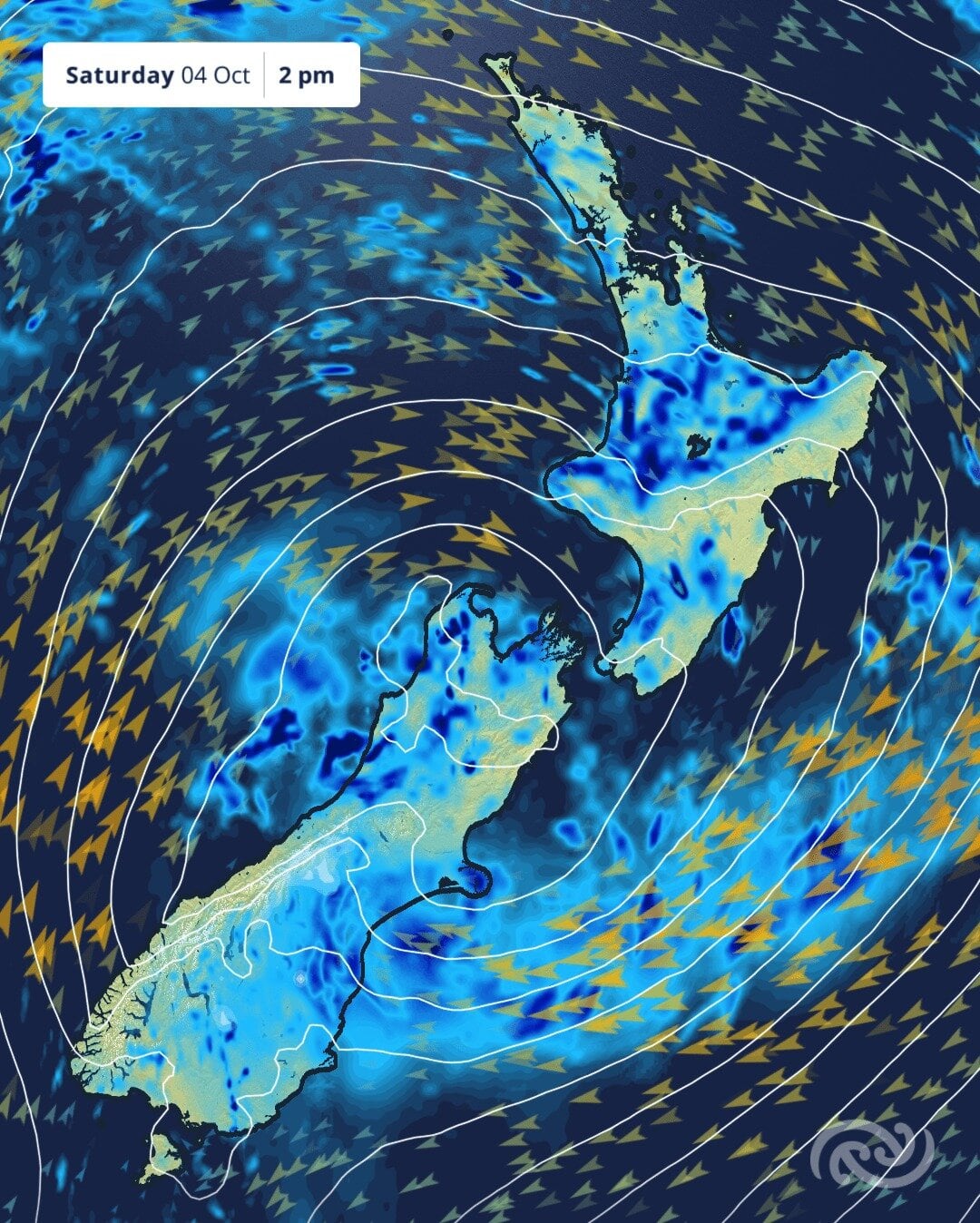
A weather map forecast for Saturday. Photo / Metervice

0 comments
Leave a Comment
You must be logged in to make a comment.