MetService is forecasting a warm, cloudy, and wet summer-like day across the country, with maximum temperatures today exceeding November averages in some areas.
Hastings was tipped to reach 31C. Similarly, Napier was expected to reach 29C, while Ashburton and Timaru were anticipating 26C, and Christchurch was expected to see around 25C.
All these temperatures were higher than usual November averages.
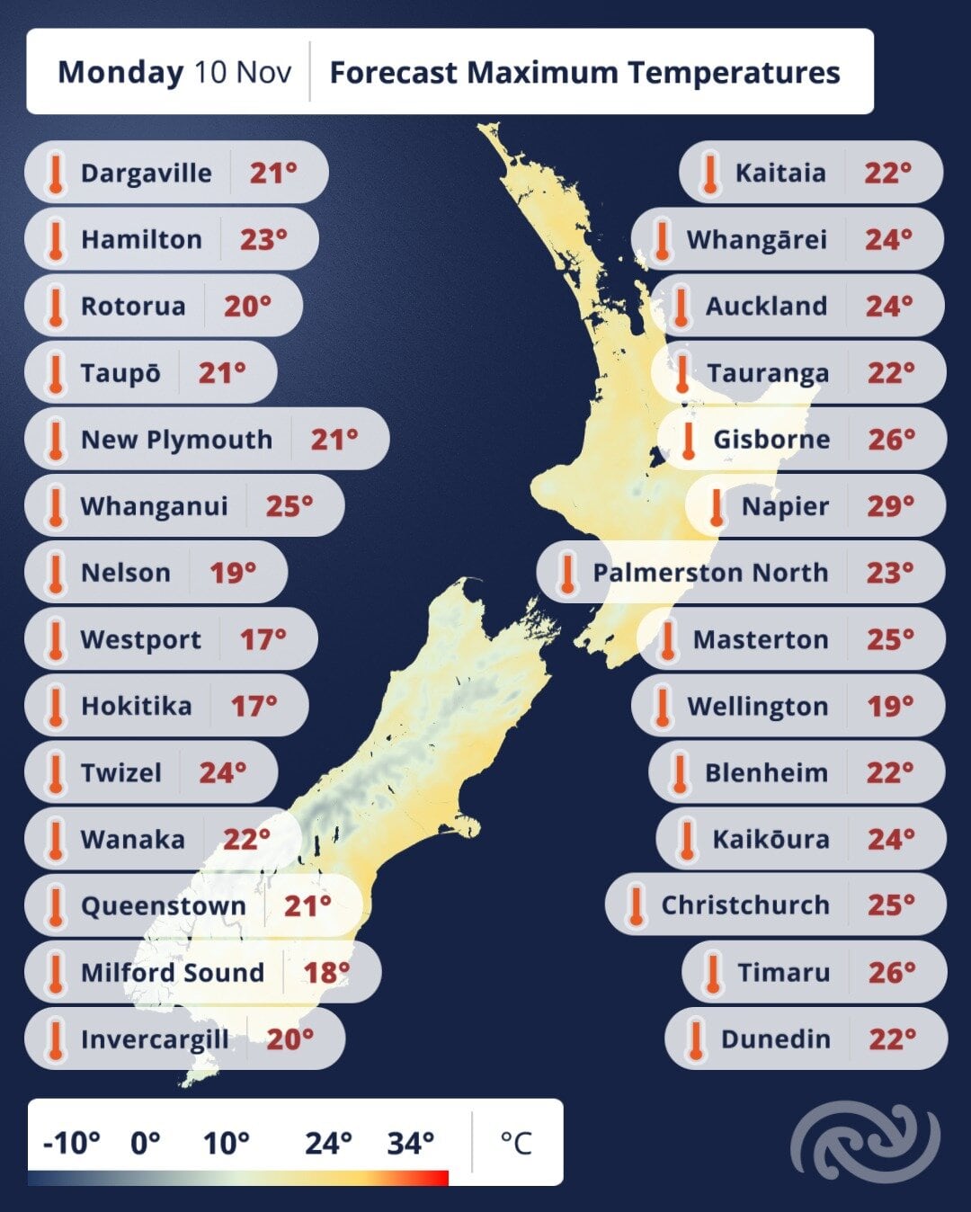
Metservice forecasted summer-like temperatures for today. Photo / MetService
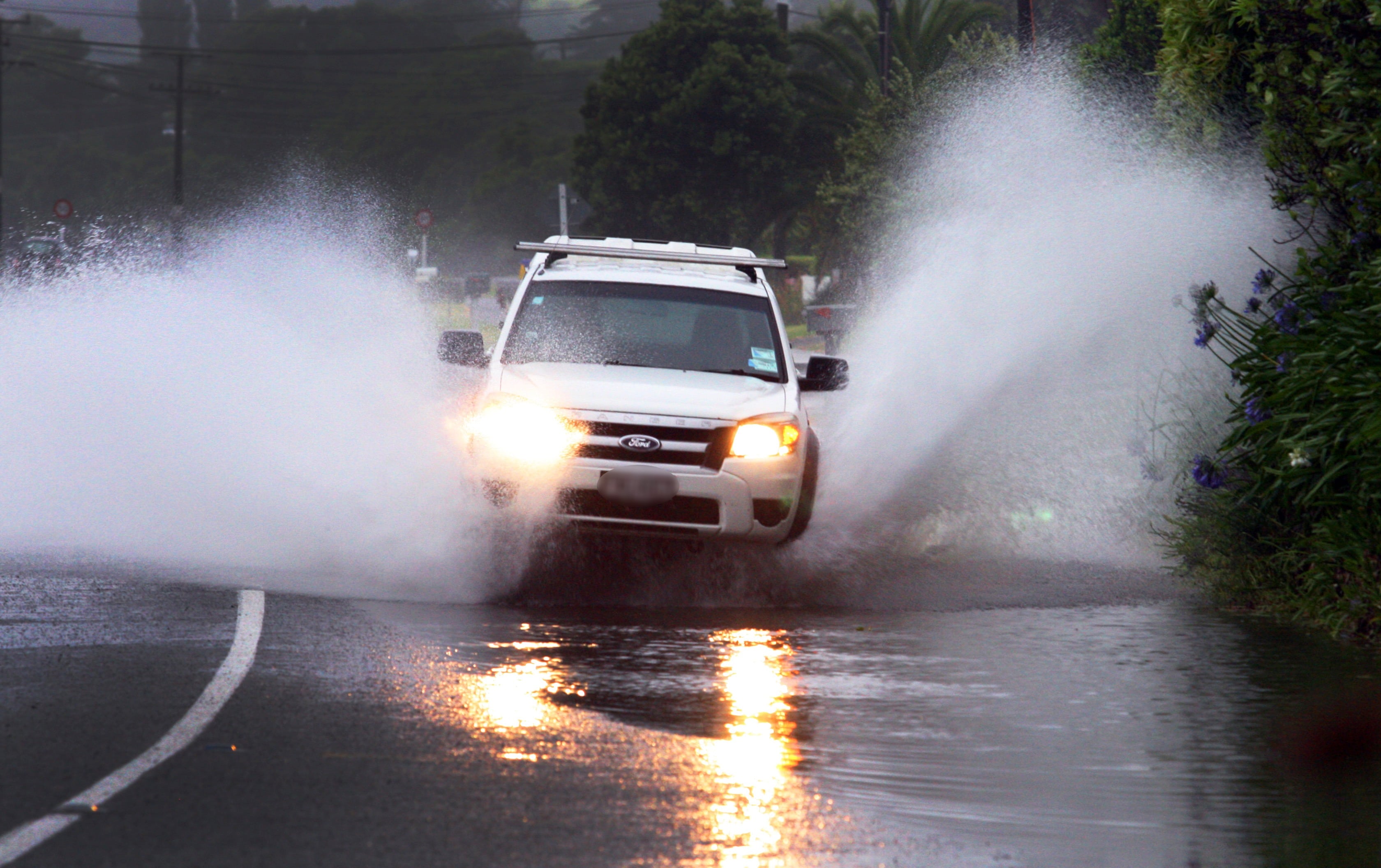
Active weather was expected to return on Wednesday as a low-pressure system moves onto the North Island, bringing possible heavy rain, with embedded thunderstorms.
There was a possibility of heavy rain in parts of the North Island, including Northland, Auckland, Coromandel, Waikato, Bay of Plenty, and northern Gisborne.
“These warm temperatures will enhance the occurrence of showers this afternoon, which may impact the T20 cricket Black Caps v West Indies match happening in Nelson today (Monday),” MetService meteorologist Samkelo Magwala said.
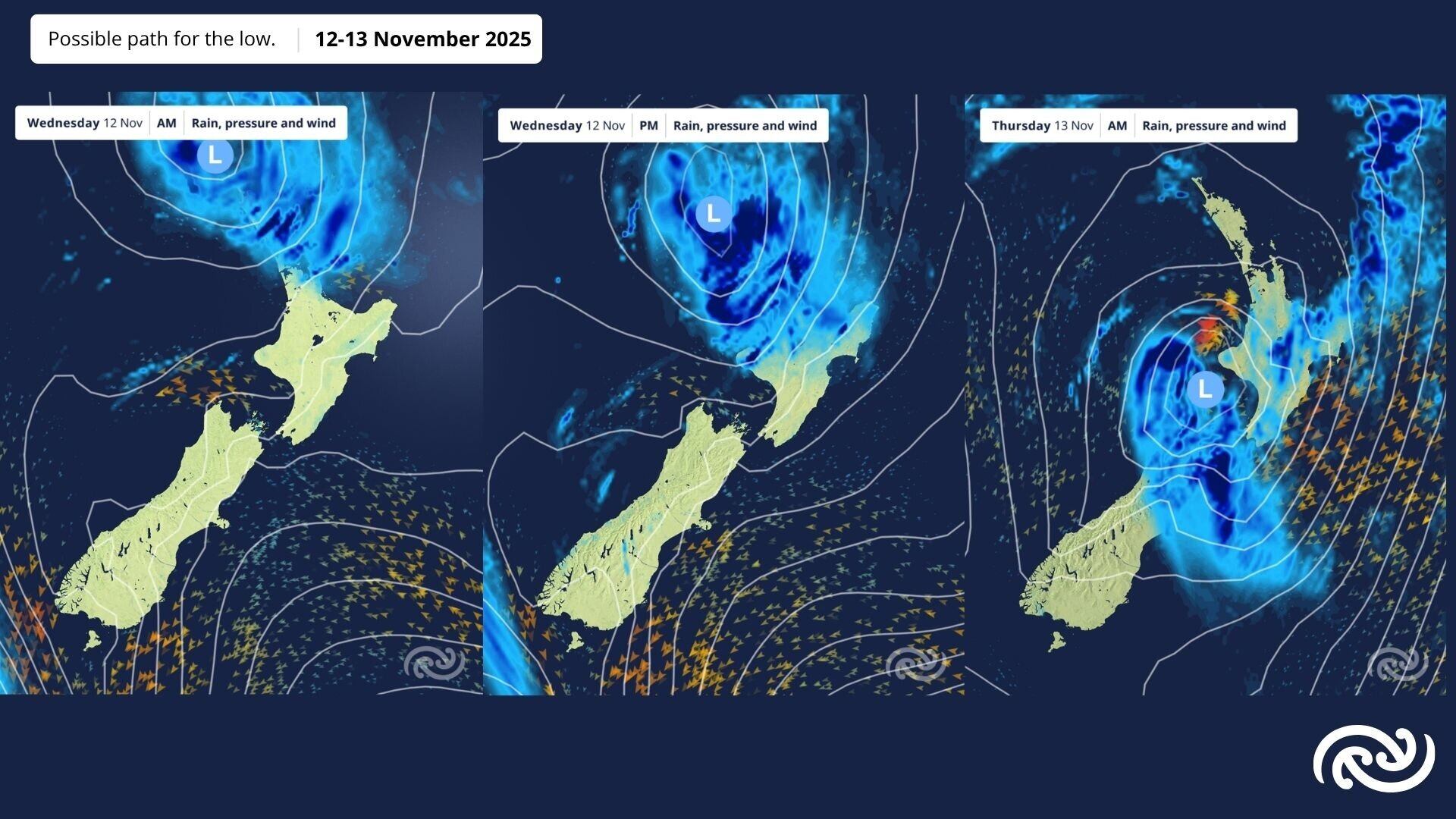
Wet weather is expected on Wednesday and Thursday with warnings and watches likely to be issued.
“However, conditions are looking better for Cup Day in Canterbury tomorrow (Tuesday), as showers are expected to clear before dawn.”
Northland may experience very strong winds.
MetService would continue to monitor the situation and provide necessary updates. Kiwis, especially North Islanders, were encouraged to keep an eye on the forecast.
“Wet weather continues into Thursday and extends to the South Island,” Magwala said.
“The latter part of the day into Friday is looking better for outdoor activities in the North Island and eastern South Island, before the next front moves north from the lower South Island on Friday morning.”

0 comments
Leave a Comment
You must be logged in to make a comment.